")
")
")
Project Visualisation
Zederhaus LSW Istanbul Bayrampasa Istanbul Monorail St. Pölten GZU Kassel, real-time traffic simulation
Zederhaus, Noise Barrier
|
The motorway and expressway provider ASFiNAG is responsible for the expansion, maintenance and management of the Austrian motorway network. Their tasks also include the construction of noise protection measures. Due to the unfavorable valley shape, especially high noise barriers had to be planned in the Zederhaus area.
|
||
|
|
||
| top of page |

Istanbul, City Development Bayrampasa
|
In the Istanbul district of Bayrampasa, the untapped area of a former prison is to be rebuilt. It is planned to erect 2200 apartments, shops, schools and a large mosque. The department of urban development of the city administration has therefore commissioned UVM Systems with a 3D visualisation of the project area, which was created using CityGRID®. The existing 3D city model has been improved around the planning area by a detailed presentation of the facades and the road area. In scope of the former prison, the terrain model had to be refined, the planned terracing had to be worked in and the new roads, trains and bridges were modelled. A new shopping centre, schools and the planned residential buildings were modelled and inserted into the scene.
|
||
|
|
||
| top of page |


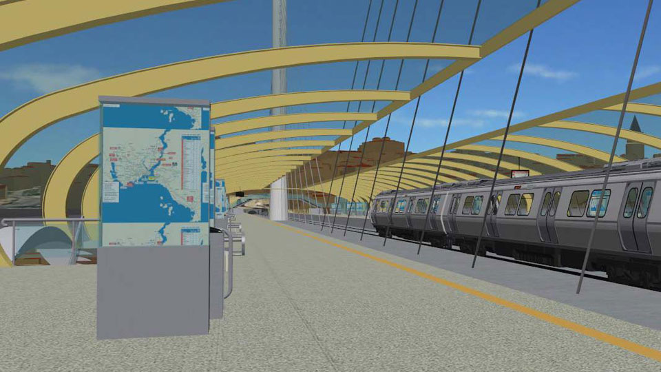
Istanbul Monorail
|
Between the Istanbul airport Atatürk and the district Basaksehir a 14km long monorail route with 16 stations is planned. The Department of geo-information of the city administration has commissioned UVM Systems with the visualisation of this project.
|
||
|
|
||
| top of page |
Train Bypass, St. Pölten
|
The St. Pölten freight train bypass is a new route from ÖBB Infrastruktur AG and serves to improve the capacity on the Vienna-Linz railway line. ÖBB has set up an information kiosk called "Infobox" in which interested persons can get information about the railroad project. In this Infobox, visitors should also be given the opportunity to interactively explore the new route. To this end, we have created a detailed 3D model of the to be constructed track and embedded it in a realistic model of the affected landscape. For the visualisation, we have set up an interactive installation based on CityGRID® Scout. As soon as a person enters the Infobox, this installation starts automatically and invites you to the interactive flight over the planned route. In this way, you can playfully experience how the new railroad track will fit into the real environment.
|
||
|
|
||
| top of page |

Kassel, real-time traffic simulation
|
The civil engineering department of the city of Kassel uses the Vissim system from PTV to simulate traffic flows in various planning variants. On the occasion of the planned redesign of the critical traffic junction “Brüder Grim Platz”, it was necessary to show the traffic simulation in three dimensions in the digital city model in order to communicate with citizens. A software interface developed by UVM Systems enables Vissim to be directly linked to CityGRID® Scout. All road users simulated by Vissim – cars, trams, cyclists, pedestrians, etc. – now move through the 3D city model in real time. In this way, the spatial effects of a particular traffic planning variant on urban space can now be assessed much better within the framework of citizen participation.
|
||
|
|
||
| top of page |
