")
")
")
3D City model
Vienna Hamburg Canton of Lucerne Prague Swisstopo Istanbul Bern Cassel Zurich Konya Linz Reutlingen Wiener Linien
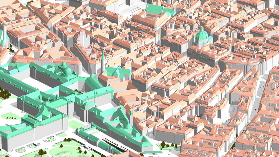
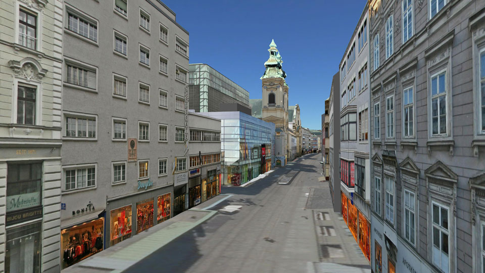
Vienna
|
The city of Vienna needs the city model as a 3D extension of the city's basic map. The first version of the city model was already built in 2004 with the help of its own photogrammetric roof evaluations.
|
||
|
|
||
| top of page |
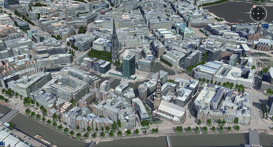
Hamburg
|
The city of Hamburg makes its city model publicly available in various qualities. In addition to the LOD 1 and LOD 2 versions, a comprehensive LOD 3 model has now also been created. The building modelling was carried out by the company UVM Systems GmbH, the roof landscapes were evaluated in detail from current aerial photos, as well as the facade lines on buildings with large roof overhangs. The 3D modelling and complete texturing was carried out using the CityGRID® system. The urban department for geoinformation and surveying (Landesbetrieb für Geoinformation und Vermessung) also uses the CityGRID® software to manage the 3D city model.
|
||
|
|
||
| top of page |
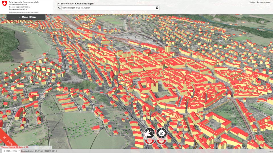
Swisstopo
|
As part of the Topographical Landscape Model (TLM), the Swiss federal office of land surveys "swisstopo" decided to provide 3D models of all buildings in Switzerland. The goal is the nationwide survey of all buildings including significant roof superstructures from an 8m side length and roof overhangs. The data are distributed under the product swissBuildings3D 2.0.
|
||
|
|
||
| top of page |
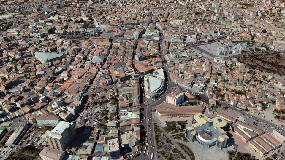
Istanbul
|
The city of Istanbul is currently the largest CityGRID® customer, with approximately 1.5 million building models. The city model was constructed from LIDAR point cloud data, with the main aim of automatically modeling the main roof shapes without great interactive effort. A refinement of the city model by detailed modeling and automatic texturing (currently ~ 400km² from vertical images) is successively carried out using CityGRID®. A complete automatic texturing of the entire city model with highly overlapping aerial images and mobile mapping images is planned. The main application areas of the city model include project visualisations, visibility analyses, urban energy infrastructure and public transport planning. The city model will be made accessible to the public in the near future.
|
||
|
|
||
| top of page |

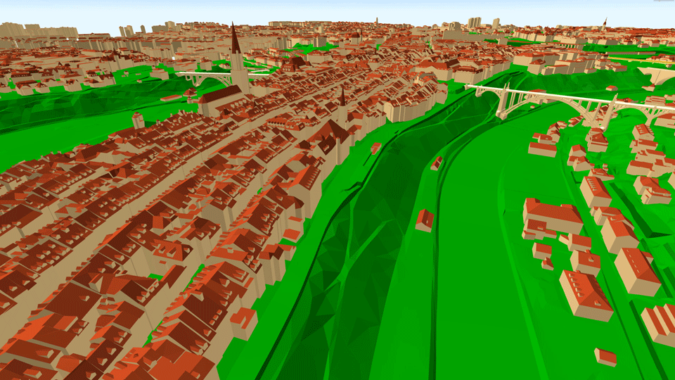
Bern
|
The 3D city model of the city of Bern is an integral part of the digital landscape model and comprises about 20,000 building models. Since 2012, CityGRID® software has been used to manage the city model. Thanks to its good accuracy and detail, the model is used intensively for planning tasks, both from the city planners as well as from external project planners. The Bern city model is designed and managed by the surveying office in the directorate for civil engineering, transport and urban green. In order to optimize workflows, the surveying office also uses FME routines specially developed by UVM Systems.
|
||
|
|
||
| top of page |
Kassel
|
In the course of a solar potential analysis project, the buildings of the City of Kassel were photogrammetrically recorded. As a result, the municipal surveying and geoinformation departement was able to use these data to create a 3D city model. Using the CityGRID® software and an FME-based workflow for 3D data migration, the building models could be created with roof overhangs to match the ALKIS floor plans. During this project, the workflow ensured that building models were automatically separated by given ALKIS footprint boundaries, and building footprints without roof covering were identified. In addition, the city model was completely textured from terrestrial recordings and from aerial photographs. The 3D city model is used within the city administration for planning tasks.
|
||
|
|
||
| top of page |
Zurich
|
The city of Zurich offers a very detailed 3D city model with roof details and roof overhangs. Zurich was one of the first cities in Switzerland which strictly based its city model on the CityGML data structure. The city model is managed by the Department of Geomatics and Surveying, the GIS Competence Center is one of the main users in the city administration. The urban model is also used extensively by external planners. For this reason, the ongoing update, which has been implemented with the CityGRID® system since 2012, is very important. A special advantage is the good integration of CityGRID® into the given CityGML data structures.
|
||
|
|
||
| top of page |
Konya
|
As the first city in Turkey, Konya is using the method of manual photogrammetry to create a city model. Starting from the city core, the city model is successively restituted in LoD3 and modeled using CityGRID®. Konya is also a pioneer in the area-wide texturing of the city model from aerial images. Roofs were textured with vertical and facades with oblique images using CityGRID®. In addition, important shopping streets are supplemented with manually placed textures from hand-held photographs. From the outset, Konya relied on CityGML data structure for data management. The integration with official surveying was also carried out in order to be able to use the city model for various applications. The city model is online accessible to the public.
|
||
|
|
||
| top of page |
Linz
|
The combination of technology and art is a special "trademark" of the city of Linz, where among other things the renowned Ars Electronica Center is also domiciled. The desire to present the city in a forward-looking and attractive form led in 2007 to the creation of the digital 3D city model. From the very beginning, the city model was developed, continued and visualized with the CityGRID® system. The city center is represented by a detailed, photogrammetric model, which is interactively textured with retouched hand-held images. In addition to this, there is an automatically generated, generalised model, which is based on sample roof shapes. The automatic texturing of this surface covering model was also carried out using the CityGRID® system.
|
||
|
|
||
| top of page |
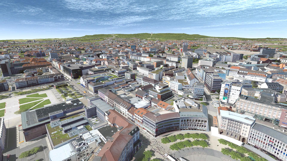
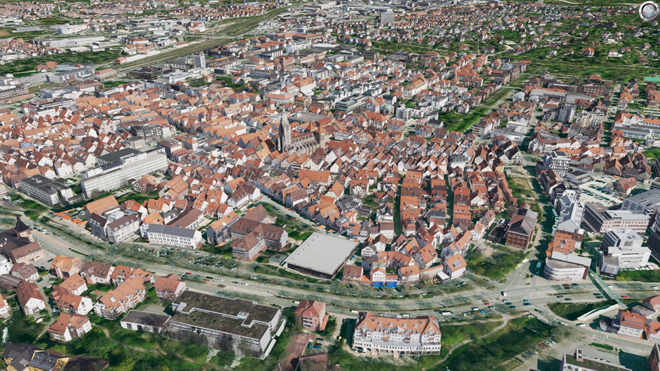
Reutlingen
|
The city of Reutlingen needs an accurate 3D city model for the city map throughout the city.
|
||
|
|
||
| top of page |
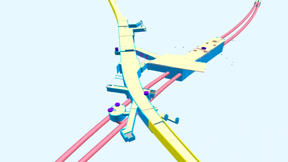
Wiener Linien
|
The Vienna public transport organisation ("Wiener Linien") is obliged to provide the data of subterranean structures of the underground to the central cadastre of pipework ("Zentraler Leitungskataster" - ZLK). UVM Systems has been commissioned with implementation since 2011. To ensure that this data processing is also beneficial to Wiener Linien itself, a 3D modeling of all underground structures from the available planning documents took place at the same time. There are now georeferenced 3D models representing the massive load-bearing components of all subterranean underground structures. These 3D models are kept up-to-date in line with various construction measures and will be available as 3D geo base data in the digital infrastructure database of Wiener Linien. For the use in the framework of the ZLK, 2D outlines can also be derived from the 3D models. Using the CityGRID® system, the underground models can be managed and used together with the 3D city model.
|
||
|
|
||
| top of page |
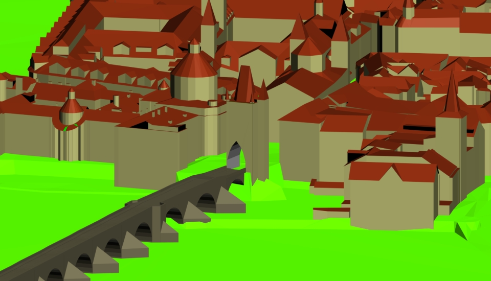
Prague
|
The IPR (Prague Institute of Planning and Development) is responsible for municipal urban planning and has developed a 3D city model for this purpose. The continuation and administration of the model takes place since 2018 with our CityGRID® software. The IPR particularly appreciates CityGRID®'s tools for automated repair of the existing city model, as well as efficient 3D refurbishment and texturing of building models.
|
||
|
|
||
| top of page |
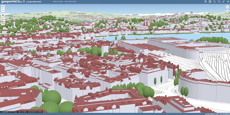
Kanton Luzern
|
In the canton of Lucerne, 3D geodata is required, among other things, for the assessment of construction projects, for the determination of densification potential in settlements, for real estate valuations and for the simulation of the spread of emissions. For this purpose, UVM Systems GmbH modeled all cantonal buildings using the CityGRID® software and precisely referenced them to the building footprints from the official survey.
|
||
|
|
||
| top of page |