")
")
")
Bremen
|
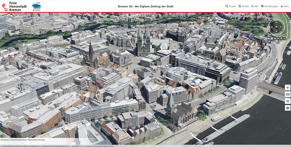
The Bremen urban departement for geoinformation makes a 3D city model publicly available at level of detail LOD 2. To upgrade this city model, UVM Systems GmbH was commissioned in 2022 to automatically texturize the building models. This improved the clarity of the city model significantly.
|
||
|
|
||
| top of page |
Frankfurt
|
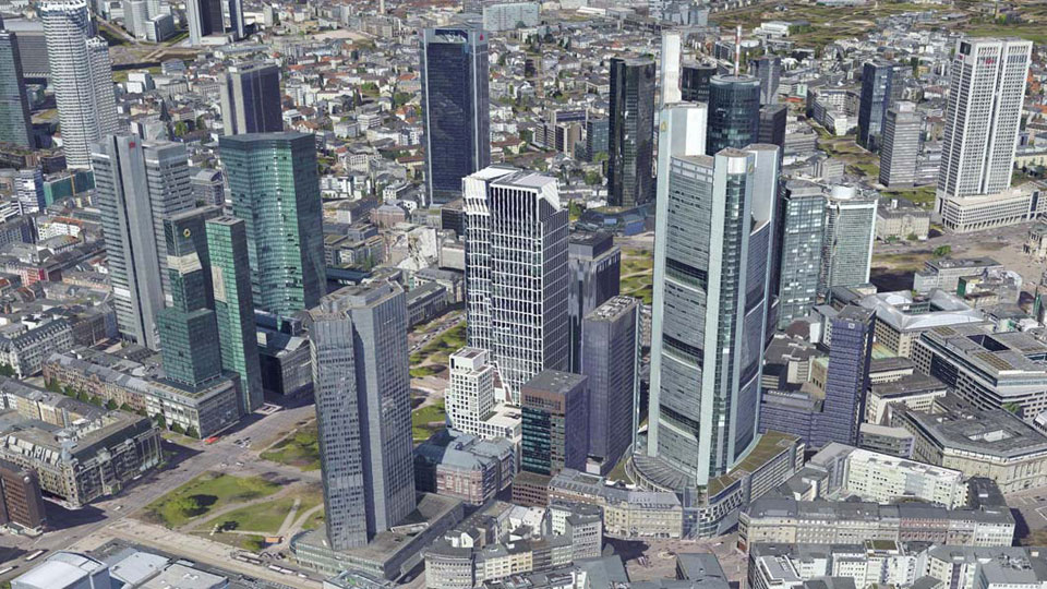
The 3D city model of Frankfurt consists of building models, which were created by the company Virtual City Systems in 2015 on behalf of the city surveying office. Subsequently the city model data was automatically texturized with the aid of current oblique images and the CityGRID® software and delivered in the format CityGML 2.0. The textured city model Frankfurt is used for environmental protection, energy saving measures, land use planning, monument protection and tourism advertising.
|
||
|
|
||
| top of page |
Helsinki
|
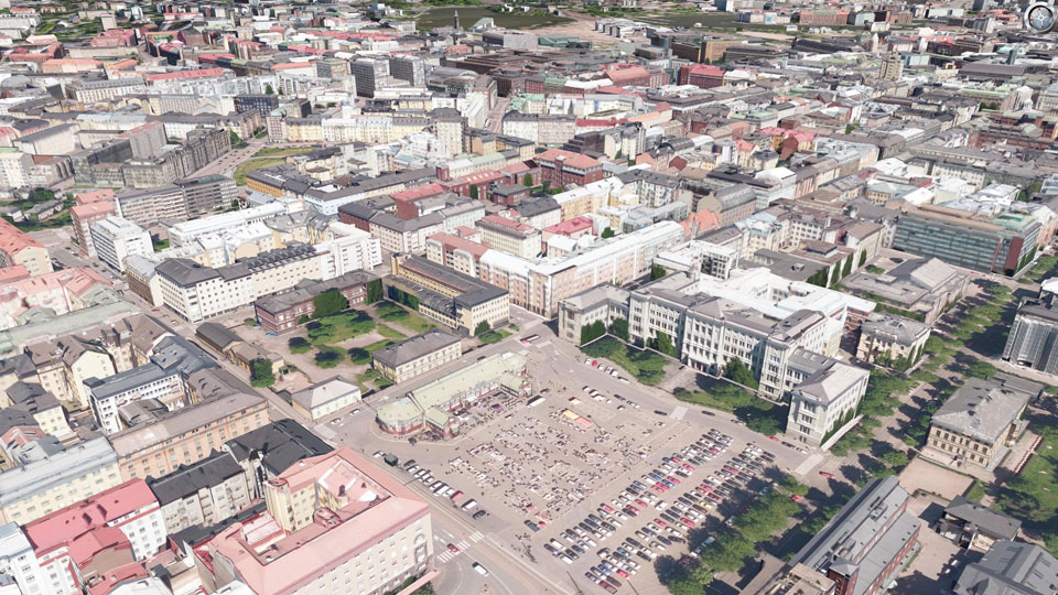
The city model of Helsinki (created by the company Virtual City Systems) was textured with an UltraCam Osprey by order of the city administration, department of information technology and communication, by means of nadir and oblique aerial images from a 2016 flight. Thanks to the high overlap of these aerial images, textures could be determined with minimal occlusions using the automatic visibility analysis. The entire city model was texturized within 3 weeks using CityGRID® software and delivered in CityGML 2.0 format. On the internet, the textured 3D city model is provided by the City of Helsinki as open data (https://kartta.hel.fi/3d/).
|
||
|
|
||
| top of page |
Lucerne
|
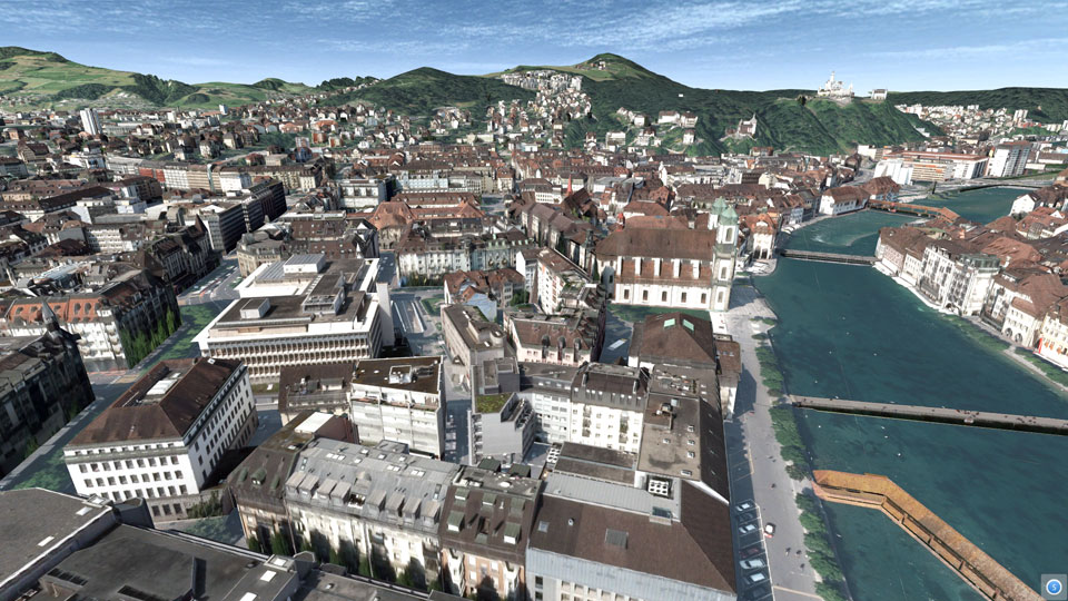
For the presentation in the Swiss Museum of Transport in Lucerne in March 2015, the existing 3D city model was to be prepared for a more public impact. As high-resolution nadir air photos were available from the last ortho photo flight, UVM Systems was able to carry out automatic texturing of the city model in February 2015. The textured model was presented as part of an interactive installation during the 4D GEO Symposium with great success. Since then, the textured city model has also been available to the city of Lucerne for a clearer presentation of planning projects.
|
||
|
|
||
| top of page |
Berlin
|
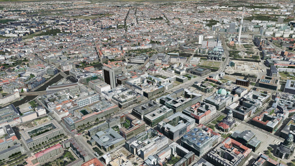
The comprehensive 3D city model is managed by the senate department for urban development and is also used for innovative location marketing. In order to provide potential investors with a better view of the situation the city model had to be textured completely, using the most efficient way. For this purpose, a separate image flight took place in summer 2013 with the new Ultracam Osprey oblique image camera system. The area around the airport Tegel had to be flown in a larger height with a conventional Nadir camera system. The automatic texturing was finally carried out from November 2013 to January 2014 by UVM Systems. For the first time, texturing was performed directly on CityGML files, which were stored in the database schema "CityDB", which significantly reduced the computation time.
|
||
|
|
||
| top of page |
Stuttgart
|
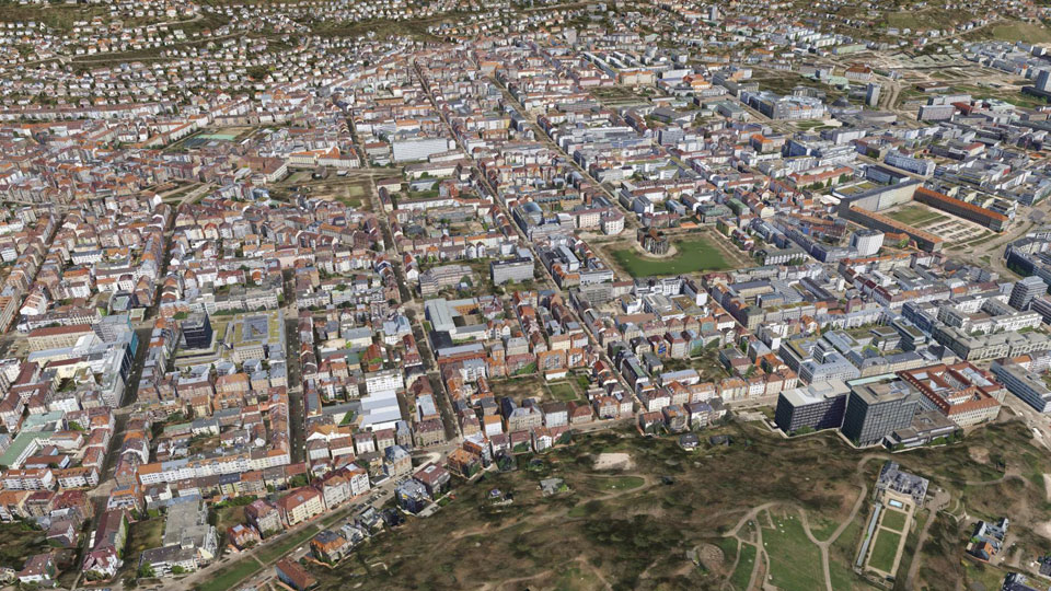
In the summer of 2014, Stuttgart was covered by an aerial image flight. These images should be subsequently used to texturize the existing 3D city model. In advance some deficiencies that were present in the 3D data structures, e.g. wrongly oriented faces in the building models, had to be corrected. UVM Systems carried out both tasks from November 2014 to January 2015 with the CityGRID® system. Due to the complete texturing, the 3D city model provides a much more intuitive photo-realistic impression now. The city model Stuttgart is available for city administration, business and citizens and is kept up to date.
|
||
|
|
||
| top of page |
Luxembourg
|
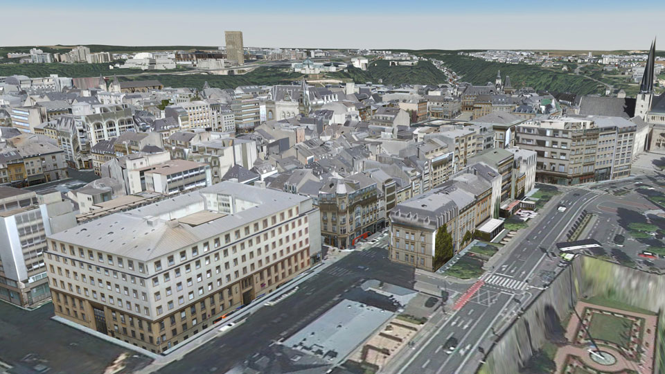
In 2014, a mobile mapping of the city of Luxembourg was carried out by Cyclomedia vehicles. On the occasion of the "Luxtram" tramway project, the comprehensive texturing of the existing city model from these facade photographs was in demand. The processing was carried out by UVM Systems using the CityGRID® system. Building faces which could not be textured from the mobile mapping data, such as roof landscapes or facades on the courtyard, got the texture information from nadir aerial images. In addition, the facades along the configured Luxtram route were modeled in more detail by combining the Cyclomedia image data server with the CityGRID® system.
|
||
|
|
||
| top of page |
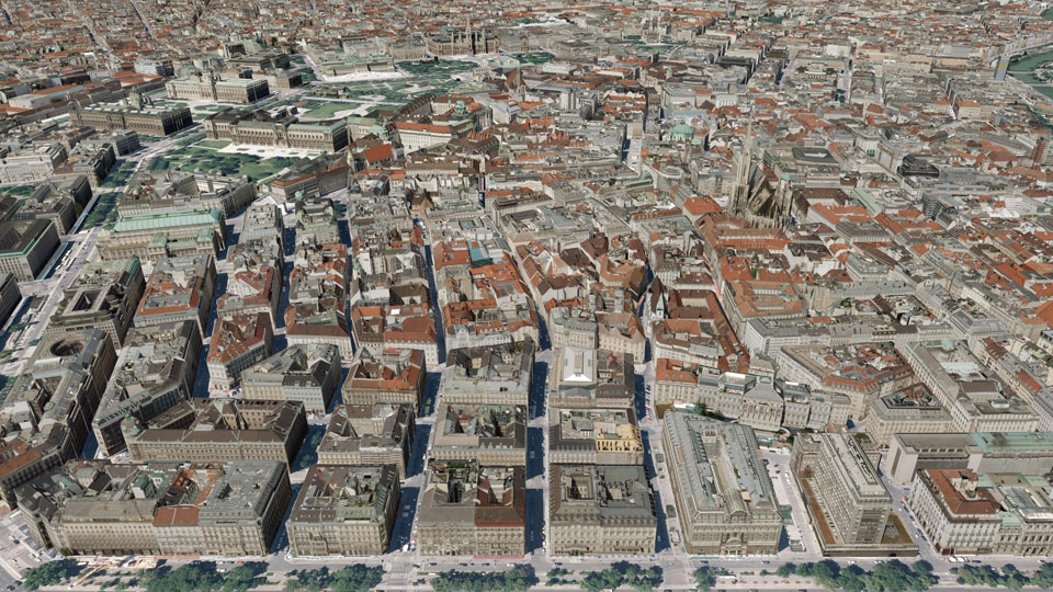
Vienna
|
The City of Vienna plans to establish a free download of the generalized version of the 3D city model (LoD 2 by definition of SIG 3D). To improve the clarity, UVM Systems was commissioned with automatic texturing. In this case, the output data format CityGML had to be strictly reproduced in its predefined structure. The aerial photographs of the year 2015, which were also used for the automated creation of the 3D city model, were available as data bases. Thus, contradictions between the building models and the aerial texture could be excluded from the outset. Texturing was carried out between October and December 2016 using the "CityDB" CityGML database schema. In the course of this work, the existing city model went through a correction of geometrical and semantic deficits and was supplemented by information on adjacent facades. The knowledge about these "warm facades" (adjacent facades) is particularly valuable for energy supply simulations. The textured 3D city model is publicly provided by the City of Vienna in format CityGML.
|
||
|
|
||
| top of page |
Darmstadt
|
In 2012, the entire urban area of Darmstadt was documented by a Cyclomedia mobile mapping campaign. As a result, high-resolution panoramic images of the road area are available. These images were used for texturing the facades of buildings. Conventional aerial photographs were also available for the roof landscape and for the facades, which were not visible from the street. The combined texturing from panorama aerial imagery was realized in 2012 with the system CityGRID®. Subsequently, this textured model served as a model for the detailing of the city model. Concretely, it was possible to derive drive-throughs, arcades and superstructures from the facade textures. The fully textured city model is mainly used for municipal planning tasks.
|
||
|
|
||
| top of page |