")
")
")
3D City models
Creation Refinement Update Texturing Terrain model 3D Printing
Creation
|
We give useful recommentations to customers who want to start creating a 3D city model based on our many years of experience:
After clarifying for a particular customer which quality of the 3D city model is the optimal and affordable, we can also offer the creation of the 3D city model. With our partner companies, we can create city models at all levels of detail, from simple and cost-effective to highly accurate and detailed models. We can also carry out photorealistic texturing flexibly according to the wishes of our customers. We always carry out final steps of the creation of a 3D city model ourselves in our company, which is followed by our final quality control. We can deliver the digital 3D city model in all desired data formats (e.g. CityGML, ESRI-Shape, etc.). |
||
|
|
||
| top of page |
Refinement
|
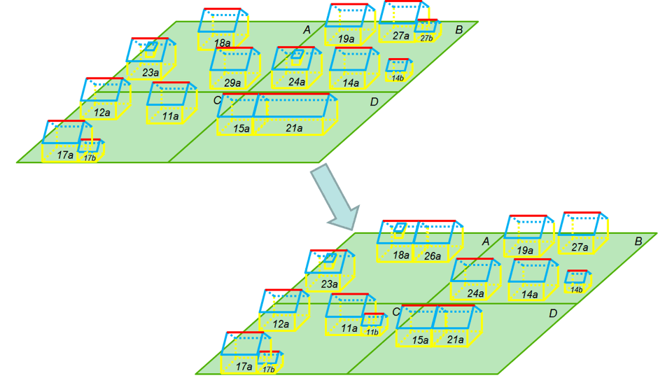
Many of our customers already have a simple 3D city model that they want to refine. With our CityGRID® With the help of conventional photographs, we can texture the facades of the building models. For high demands, we can also create architectural models with modelled facade details. In addition to the geometric refinement, the structure of the city model often needs to be improved. In general, existing Geo Information System (GIS) or the cadastre define what is a "building". If the 3D city model should have a building part separation, we can transfer it into the desired building structure in the course of a "3D migration". We automatically carry out the fusion and division of existing building models necessary for the new structure, as well as the assignment to the existing building identifiers. |
||
|
|
||
|
|
Update
|
Buildings of a city change with time, new buildings are being built, existing ones are expanded and old buildings are torn down. Therefore the digital city model has to be updated regularly, typically every 2-3 years.
For building modeling we use automatic procedures or photogrammetry, depending on how the original city model was created. As a result of our update, we supply the current building models including the database commands for adding, changing or deleting the affected building units. |
||
|
|
||
| top of page |
Automatic Texturing
|
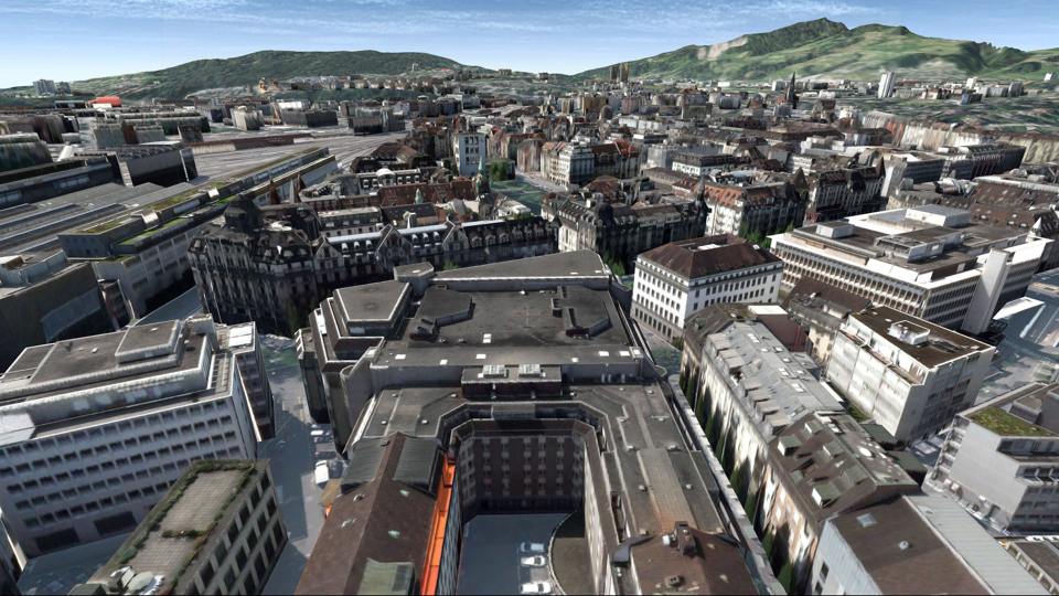
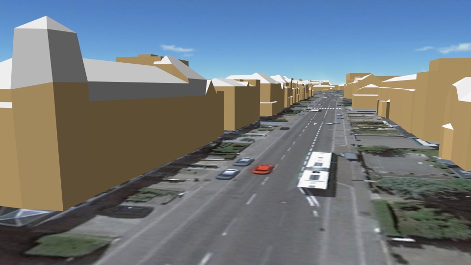
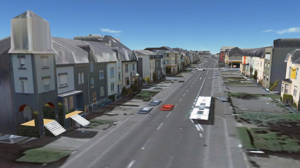
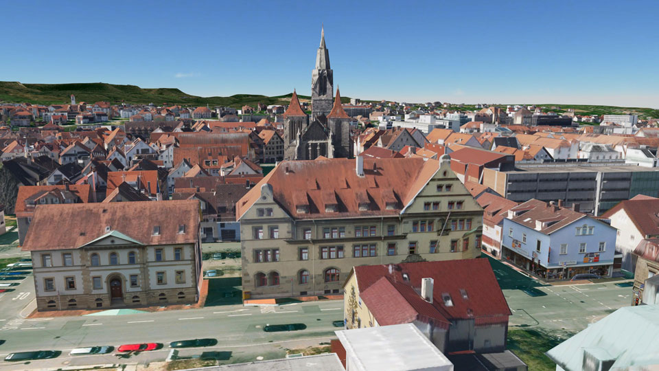
For many technical applications, such as visibility analysis, it is sufficient to consider only the shape of the buildings in the 3D city model. For public presentations, however, the photorealistic texturing of the city model is recommended because it makes it much easier to orient in the model and the acceptance is increased. Thanks to texturing, the city model appears much more detailed as it might even be. Windows, doors or roof structures can be seen, although they are not modelled in the geometry of building models. Our cost-effective process for the complete texturing of the roofs and facades of the entire city model is based on georeferenced aerial images as they are typically available for all major cities. Even for capital cities with several 100,000 buildings, we are able to perform an automatic texturing of aerial images within a couple of days. The resolution of the texturized model is suitable for visualization in overflights. If you also want to offer a visualization from the pedestrian perspective, the typical resolution of aerial images is no longer enough. We can, however, offer high-resolution texturing from georeferenced panoramic images of mobile mapping systems in advance. This method also works automatically and provides detailed textures on the street-side facades of the building models, which also look appealing when viewed from the pedestrian perspective. |
||
|
|
||
| top of page |
Terrain Model
|
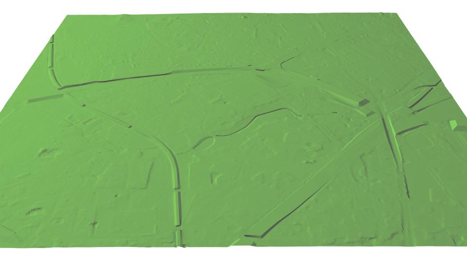
In the course of urban modeling, often the need for an appropriate terrain model arises. Often only rough terrain models are available from the National Mapping Agencies. In order to turn the invenstment in building modeling into appealing 3D vizualisations, such rough terrain models have to be improved. Important for the 3D view are, above all, cleanly modeled break edges of embankments, retaining walls, bridge heads etc. We can offer the corresponding improvement of urban terrain models from existing 2D or 3D data. For high quality requirements, we can also perform a photogrammetric restitution of the relevant break edges and thus derive a terrain model that is ideally suited for 3D applications. In a further development stage, bridges can also be recorded and combined with this terrain model. |
||
|
|
||
| top of page |
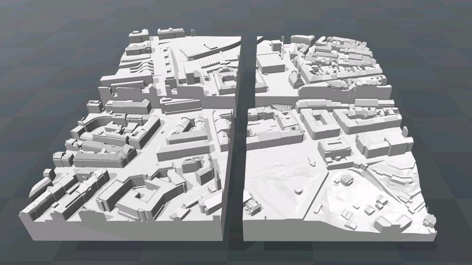
3D Printing
|
Despite the increasing spread of digital city models, the traditional "haptic" (analog) city models are still demanded. These analog models can be printed directly from the digital city model using modern 3D printers. This reduces costs while increasing the quality of analog city models. The update of analog city models is now much easier to accomplish thanks to 3D printing. We offer as a service the preparation of city model data in the form of printable files adapted to the limited space of the 3D printer. As a result, even large analog city models can be made up of a large number of printed tiles. If desired, we can also produce a stepped version of the terrain model, so as to get as close as possible to the familiar effect of handmade models. |
||
|
|
||
| top of page |