")
")
")
Pipelinetool, BIMTAS
|
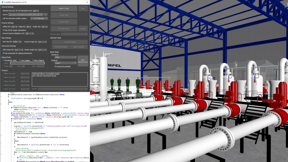
For the company BIMTAS (Istanbul), a new software tool has been developed which can be used to model the existing or planned gas pipeline network from 3D GIS data. In August 2017 BIMTAS began to model the entire gas pipeline network of Istanbul automatically in 3D. Initial data are 2D GIS gas lines and points which are first attributively enriched with FME workspaces, and then brought into the correct 3D height. For preparation, a total of 697 models of instruments were created by BIMTAS in a realistic way and stored as a 3D library. The pipeline tool accepts these initial data and
As a result, the pipeline tool provides a watertight 3D model of the gas network. In the city of Istanbul, this model is used to simulate construction work on the gas network, for planning new metro projects and for marketing purposes.
|
||
|
|
||
| top of page |