Select your language

Kanton Luzern


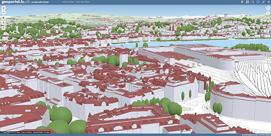
In the canton of Lucerne, 3D geodata is required, among other things, for the assessment of construction projects, for the determination of densification potential in settlements, for real estate valuations and for the simulation of the spread of emissions. For this purpose, UVM Systems GmbH modeled all cantonal buildings using the CityGRID® software and precisely referenced them to the building footprints from the official survey.

PinionProject parameters

logo Kanton Luzern

  • Evaluation: Photogrammetric
  • Detailgrad: Main roof form with details
  • Ersterstellung: 2020
  • Gebäudeanzahl: 125.000
  • Dachüberstand: complete
  • Gebäudegrundrisse: complete


Kanton Luzern 550

 
  top of page   
  • News and Events


    CityGRID® 2025 Release

    CityGRID® Version 2025, Build 19.10.098 (Hotfix), has been published!


    Download

    Change list

     
  • New Video

    From drone flight to finished building model - possible with CityGRID!


    Watch Video

    LinkedIn

     
  • 3D Forum Lindau 2025

    Visit our workshop "3D building modeling from drone images" at the 3D Forum Lindau 2025:


    3D Forum Lindau