")
")
")
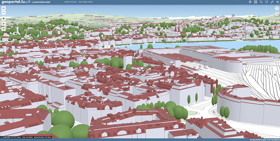
KANTON LUZERN
|
In the canton of Lucerne, 3D geodata is required, among other things, for the assessment of construction projects, for the determination of densification potential in settlements, for real estate valuations and for the simulation of the spread of emissions. For this purpose, UVM Systems GmbH modeled all cantonal buildings using the CityGRID® software and precisely referenced them to the building footprints from the official survey.
|
||
|
|
||
| top of page |