")
")
")
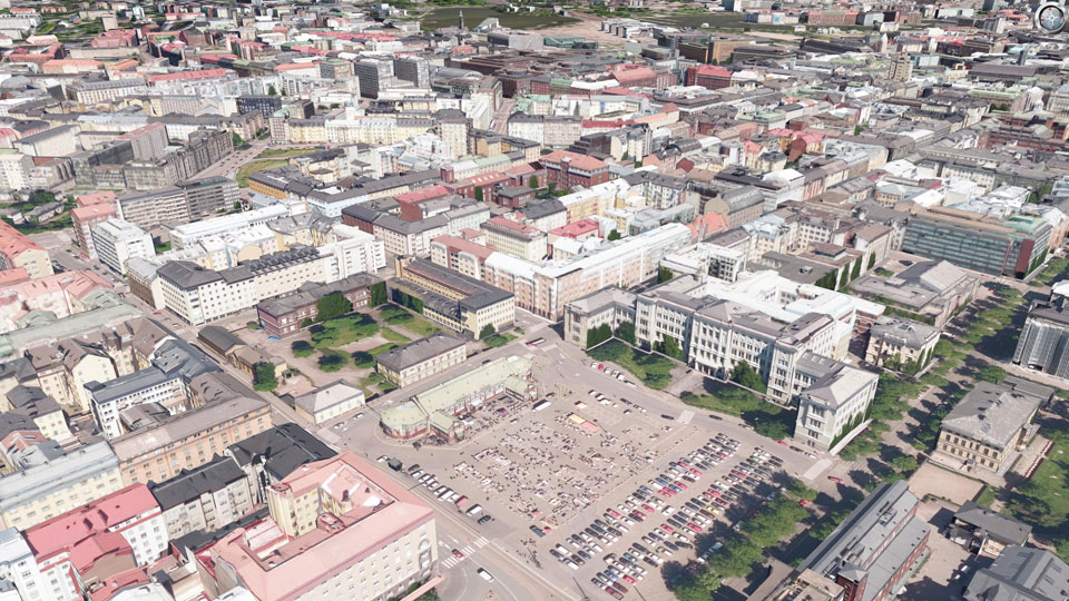
HELSINKI
|
The city model of Helsinki (created by the company Virtual City Systems) was textured with an UltraCam Osprey by order of the city administration, department of information technology and communication, by means of nadir and oblique aerial images from a 2016 flight. Thanks to the high overlap of these aerial images, textures could be determined with minimal occlusions using the automatic visibility analysis. The entire city model was texturized within 3 weeks using CityGRID® software and delivered in CityGML 2.0 format. On the internet, the textured 3D city model is provided by the City of Helsinki as open data (https://kartta.hel.fi/3d/).
|
||
|
|
||
| top of page |