Select your language

Lucerne


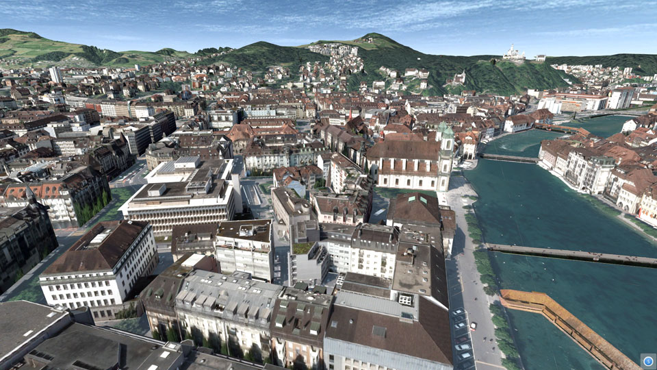
For the presentation in the Swiss Museum of Transport in Lucerne in March 2015, the existing 3D city model was to be prepared for a more public impact. As high-resolution nadir air photos were available from the last ortho photo flight, UVM Systems was able to carry out automatic texturing of the city model in February 2015. The textured model was presented as part of an interactive installation during the 4D GEO Symposium with great success. Since then, the textured city model has also been available to the city of Lucerne for a clearer presentation of planning projects.

Pinion Project parameters

  • Camera system: Ultracam XP
    Logo Luzern
  • Date of recording: 2013
  • Image type: nadir aerial images
  • Average ground resolution: 5cm
  • Coverage (nadir): 80% longitudinal / 60% transverse
  • Number of buildings: 15.000
  • Project area: 50km²


Luzern

 
  top of page 
 
  • News and Events


    CityGRID® 2025 Release

    CityGRID® Version 2025, Build 19.10.098 (Hotfix), has been published!


    Download

    Change list

     
  • New Video

    From drone flight to finished building model - possible with CityGRID!


    Watch Video

    LinkedIn

     
  • 3D Forum Lindau 2025

    Visit our workshop "3D building modeling from drone images" at the 3D Forum Lindau 2025:


    3D Forum Lindau