")
")
")
Berlin
|
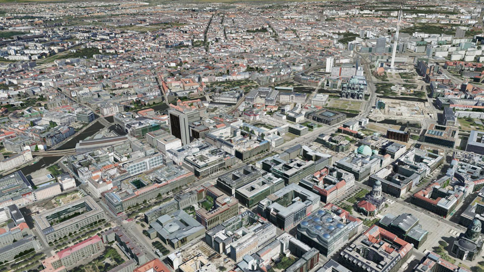
The comprehensive 3D city model is managed by the senate department for urban development and is also used for innovative location marketing. In order to provide potential investors with a better view of the situation the city model had to be textured completely, using the most efficient way. For this purpose, a separate image flight took place in summer 2013 with the new Ultracam Osprey oblique image camera system. The area around the airport Tegel had to be flown in a larger height with a conventional Nadir camera system. The automatic texturing was finally carried out from November 2013 to January 2014 by UVM Systems. For the first time, texturing was performed directly on CityGML files, which were stored in the database schema "CityDB", which significantly reduced the computation time.
|
||
|
|
||
| top of page |