Select your language

Luxembourg


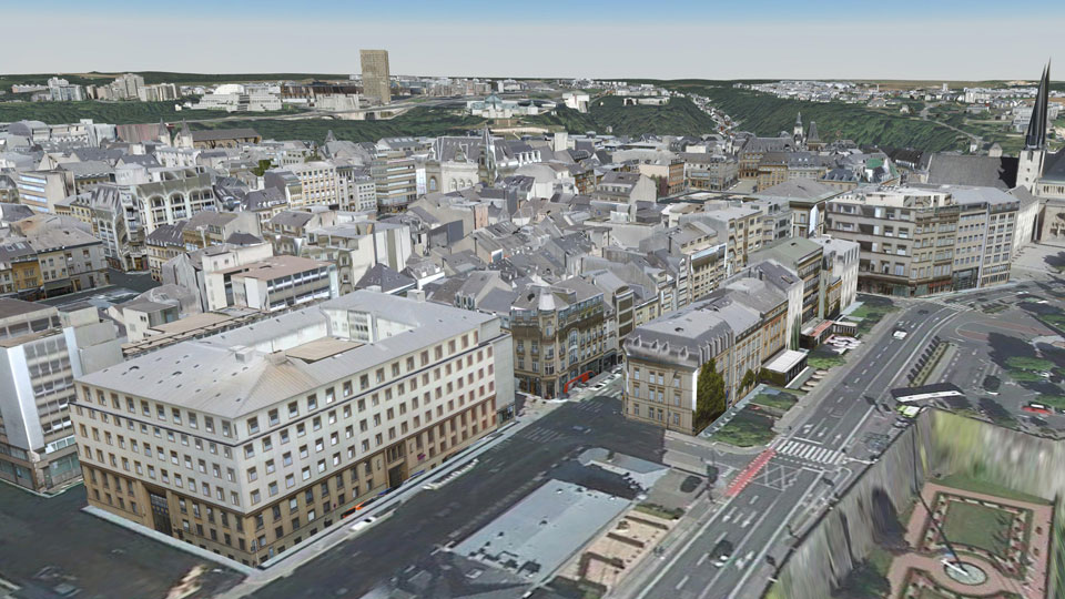
In 2014, a mobile mapping of the city of Luxembourg was carried out by Cyclomedia vehicles. On the occasion of the "Luxtram" tramway project, the comprehensive texturing of the existing city model from these facade photographs was in demand. The processing was carried out by UVM Systems using the CityGRID® system. Building faces which could not be textured from the mobile mapping data, such as roof landscapes or facades on the courtyard, got the texture information from nadir aerial images. In addition, the facades along the configured Luxtram route were modeled in more detail by combining the Cyclomedia image data server with the CityGRID® system.

Pinion Project parameters

  • Camera system: vehicle-supported Cyclomedia panoramic camera system
    logo luxemburg
  • Date of recording: 2014
  • Image type: panorama imagery "Cycloramas" as well as nadir aerial images
  • Average facade resolution: 2cm 
  • Number of buildings: 30.000
  • Project area: 320 km road length


Luxembourg

 
  top of page 
 
  • News and Events


    CityGRID® 2025 Release

    CityGRID® Version 2025, Build 19.10.098 (Hotfix), has been published!


    Download

    Change list

     
  • New Video

    From drone flight to finished building model - possible with CityGRID!


    Watch Video

    LinkedIn

     
  • 3D Forum Lindau 2025

    Visit our workshop "3D building modeling from drone images" at the 3D Forum Lindau 2025:


    3D Forum Lindau